Content Attributes
Geography is a vast and complex subject. It can be challenging to keep up with all the information, but that’s where technology comes in. There are many online tools for students and teachers alike to help make geography education a little bit easier.
12 Online Geography Tools That Are Perfect for Students and Teachers
This blog post will cover some of these online tools, explain what they do, how they work, and why you might want to use them in your classroom or your own time.
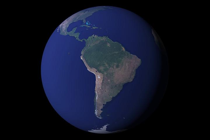
1. Google Earth:
Explore the globe with this interactive, 3D map. You can layer geographical data on top of the map to see how it impacts different regions worldwide. Besides, you get to see a 3D version that feels like you are just standing in front of the mountains, rivers, or streets. It helps you get a clear view of places and regions based on their temperature and weather conditions with detailed colors and shapes.
Zoom in to any location around the world without having to leave your house! You can spin through satellite images at different levels of magnification before zooming down onto street-level views so that you could virtually walk from place to place just by using this app. There are several other features, too, like being able to fly over cities or explore the terrain on your own.
2. National Geographic Interactive Map:
Find information on geographical features around the globe from sea level to mountain ranges. There are also other interactive maps for various topics such as climate change and population density which can be helpful in your studies.
3. Google Maps:
Find any location in all the world with this mapping software, then use Street View to explore that area interactively. This is an online mapping tool that can be used to find your location, get directions, and explore the world. Google Maps has a mobile app as well as a desktop version. Additionally, you can use this tool while riding through different regions and better understand their geography.
4. GPS Visualizer:
This tool allows you to explore the Earth and plot points for your location coordinates on a map online. So it can be used by students or teachers who need help understanding maps in their own school or at home. If you are out exploring and would like to know where you are located (or how far from another point), this is an excellent resource.
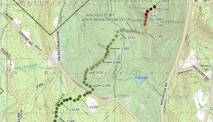
5. Topographic Map Software:
Topo maps are helpful for anyone looking to explore the landscape of a particular area. You can find topographic map software online and download it in either Windows or Mac format, depending on what computer you have at home. The best characteristic about this tool is that there are many different levels of detail available. This online tool allows you to upload your digital maps or satellite images and build a custom relief map for your classroom or project.
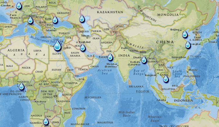
6. National Climatic Data Center (NOAA):
The National Climatic Data Center offers all kinds of information on climate change, including data sets like global monthly temperature records from the 1880-present day and projections through 2100. There’s also an online mapping function that allows users to see how various areas will be impacted by extreme weather events, which can help you start a discussion in your classroom about how to prepare for these events.
This online tool provides access to hundreds of interactive maps that can help you visualize the geographical data related to natural hazards, climate change, and more. There’s also an option for students who need multimedia instruction with text or pictures and those looking for self-guided tutorials on topics like economic geography, world religions, and population geographies.
7. eSpatial:
eSpatial is a powerful mapping platform that allows users easy visualizations of their geographic research findings from across the globe using interactive GIS tools such as historic map overlays so they can better understand what has happened historically at any given location. This would be good in history classes where teachers are teaching about wars and various other historical events.
8. World Atlas by National Geographic:
This atlas is not interactive like Google Earth, but it offers a wealth of geographical information about every country globally. Including statistical data for many countries like population density and GDP per capita. It also includes an index so students can find specific topics quickly without having to scroll through page after page of general information.
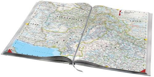
9. The Atlas of the World by Hammond’s Press:
This atlas is also not interactive, but it contains many valuable and interesting geographical facts about many different countries, including some that are difficult to find elsewhere online like Greenland or Western Sahara. It doesn’t have as much statistical data for each country. So if you’re looking for something more comprehensive on this front, then National Geographic might be better.
10. ShowMyMap:
This is an easy map creator tool that lets us create interactive maps in a matter of a few minutes. It is also useful in creating projects related to geographical locations, weather conditions, population, and various other topics. You need to enter your inputs and get an insightful view of your data to use it in educating your friends or teammates.
11. NASA Earth Observatory Visualization Explorer:
This website provides visualizations and interactive features pertaining to things. Such as the sun, moon, satellites, and different factors related to the Arctic and global weather forecasts. It’s possible to choose from topics such as sea ice, hurricanes, or even El Nino. This is a great site for finding out about what recent developments are happening anywhere on Earth at any given time.
12. National Geographic:
National Geographic has an online interactive map that you can use to show geographical information of different regions like population density or GDP per capita. There are also some really interesting articles available too which explore things like poverty, religion, conflict, and gender equality across the world, with lots of useful maps included along with them. The explanations are written specifically for students, so they’re easy enough to understand but still very informative and well-researched behind all the statistics presented on the map.
Conclusion:
Geography can be difficult because of its complexity. However, these tools make things easier by helping with research and keeping up with developments worldwide at any given moment in time.